
Smoky Mountain Files · Disaster and Recovery
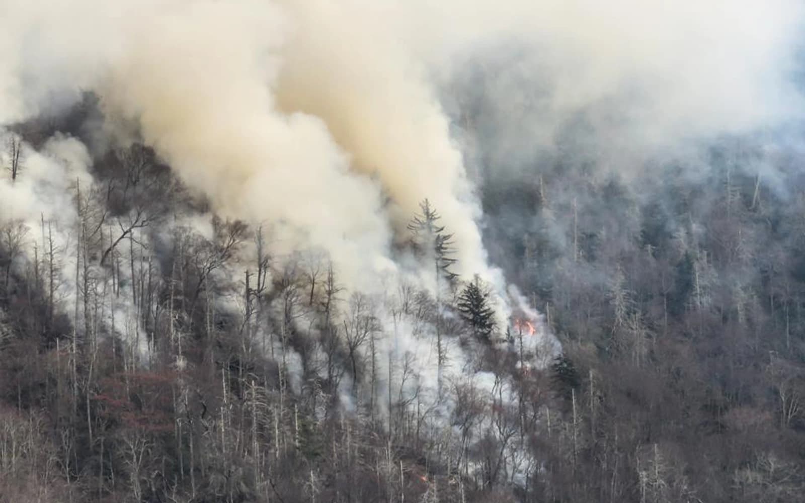
At 7:30 on the morning of November 28, 2016, maintenance workers in Great Smoky Mountains National Park saw fire in the Chimneys Picnic Area.
Another fire was already established across Newfound Gap Road.
The road had been part of the planned boundary around a small fire burning high above it. Now flames were on the other side.
Gatlinburg lay roughly five miles downhill.
The six-day timeline
| Date | Documented event |
|---|---|
| Nov. 23 | Fire reported at about 5:19 p.m.; estimated at 1.5 acres. |
| Nov. 24 | Crews design an indirect containment box of roughly 400 acres. |
| Nov. 25 | Low clouds limit visibility; an early forecast signals elevated Monday winds. |
| Nov. 26 | Fire reaches about eight acres; forecast calls for gusts above 40 mph. |
| Nov. 27 | Helicopters drop water; infrared mapping estimates 35 acres. |
| Nov. 28 | Fire is found beyond Newfound Gap Road, enters Gatlinburg that evening and prompts a citywide evacuation. |
Wednesday: A fire on the north peak
Park dispatch received the first report at about 5:19 p.m. on Wednesday, November 23. Smoke was rising near the summit of the north Chimney Top, above steep rock and dense woodland.
The park’s fire management officer hiked toward it that evening. He estimated the fire at about an acre and a half. Darkness, cliffs and burning material rolling downhill made a direct attack unsafe.
Thanksgiving morning brought another assessment. The fire had grown to about two acres. Firefighters designed an indirect containment area of roughly 400 acres, using trails, roads and topography to form a box around it. Newfound Gap Road would serve as the lower boundary.
The plan assumed crews would have time to improve those lines before the fire reached them.
Thursday and Friday: The box around the fire
Fog and low clouds limited visibility on Friday. Crews scouted possible fireline locations, but the park review records no line construction that day. The fire remained small.
Early Friday morning, the first forecast showing elevated winds for Monday reached park staff. By Saturday, the forecast called for gusts above 40 mph, followed by rain.
Rain had been scarce for months. The Southern Appalachians were in a severe drought. Leaves and forest litter were ready to burn, and the anticipated rain sat beyond the dangerous wind in the forecast.
By Saturday afternoon, the fire covered about eight acres. The terrain still ruled out a direct attack. Firefighters prepared for the indirect strategy.
Sunday: The column above the Chimneys
On Sunday, November 27, the fire became more active.
Helicopters dropped water. Crews began work on parts of the containment line. An infrared flight at about 2:30 p.m. mapped the fire at approximately 35 acres.
The city and county after-action report records no overnight monitoring of the fire. On Monday morning, maintenance workers found that it had moved beyond the planned box.
Monday morning: Beyond the road
The discovery at 7:30 a.m. changed the incident.
Fire was burning on both sides of Newfound Gap Road. Initial estimates placed the active area between 200 and 500 acres. Strong wind was already moving embers ahead of the main front.
At 10:58 a.m., according to the local after-action timeline, park staff directly contacted a Gatlinburg official about the fire. A new spot fire appeared near Twin Creeks at 11:35. Sevier County’s wildland task force was requested 17 minutes later.
At noon, Gatlinburg announced voluntary evacuation for Mynatt Park and other neighborhoods near the park boundary. An evacuation center opened at the Gatlinburg Community Center. By 2:30 p.m., Tennessee had activated statewide mutual aid.
The fire had crossed a road. The emergency was about to cross into a city.
Five hours that changed Gatlinburg
At 4 p.m., the National Weather Service warned of winds from 40 to 50 mph. Cove Mountain recorded a gust of 87 mph before its station lost power later that night.
The NPS review found no structure fires inside Gatlinburg before 5 p.m. By 6:30, multiple buildings were burning.
At 5:45, city headquarters lost electrical power, landline phones and internet service. Downed trees and utility lines blocked roads. Wind-driven embers created new fires far ahead of the main flame front, while damaged power lines ignited additional fires inside the city.
Mandatory evacuation began in Mynatt Park shortly after 6 p.m. Orders expanded as new reports arrived. At about 6 p.m., park observers saw fire leave the national park near the Park Vista hotel.
Gatlinburg ordered a citywide evacuation at 8:30.
The emergency alert system carried the message at about 9 p.m. Most people had left by 10.
During those five hours, firefighters, police officers, dispatchers, utility crews, neighbors and hotel employees moved thousands of residents and visitors through smoke, darkness, falling trees and roads that could close without warning.
By morning, a regional disaster
The fire grew from roughly 500 acres early Monday to about 17,000 acres by early Tuesday. Much of that expansion occurred between 5 and 10 p.m.
Separate ignitions and the Chimney Tops 2 Fire became one regional emergency known in the official record as the Sevier County Fires.
Fourteen people died. Nearly 200 were injured. The NPS review counted 2,545 structures destroyed or damaged. About 11,410 of the burned acres were inside the national park.
The 2016 Wildfires Memorial and Tribute Plaza at Mynatt Park now preserves the names of the fourteen people who died. One side of LeConte Creek is dedicated to them; the other recognizes the agencies and volunteers who carried out the response and recovery.
Local officials estimated that 14,000 residents and visitors evacuated. The response ultimately drew 3,535 personnel, 445 pieces of apparatus and more than 225 agencies.
The evacuation depended on thousands of decisions made while power failed, roads closed and official warnings reached people unevenly.
What the official reviews found
The National Park Service and Gatlinburg-Sevier County examined different parts of the emergency. Their reports do not reduce the outcome to one decision.
The NPS review found that early firefighting decisions matched what personnel knew and the experience available to them. It also called for a more aggressive strategy when extreme fire weather threatens, even when a fire remains small.
The review documented incomplete drought staffing, no formal fuel-moisture monitoring program, radio-interoperability problems and one official serving simultaneously as fire management officer, duty officer and incident commander. It found that the park’s Step-Up Plan for heightened fire danger had been only partly met.
The local after-action report described limited and inconsistent communication between the park and city before and during the fire’s entry into Gatlinburg. It also documented power failures, overloaded radios, downed lines, blocked routes and a bypass gate locked without coordination with the emergency operations center.
Both reports describe people operating under extraordinary conditions. The local review records improvisation and courage across a response that moved most of a city out of danger on very short notice.
The reports credit responders with moving most of the city while also identifying failures in staffing, command, communication and road access.
The warning people received—and trusted
The National Institute of Standards and Technology later surveyed 323 affected households.
Within that sample, 22.7% reported receiving any warning. Only 7.4% said they received a warning from an official source they trusted. Respondents who received a trusted warning were about five and a half times more likely to evacuate than those who did not.
Those percentages describe the survey sample. They also show why an effective warning has to reach people, identify the danger and come from a source they recognize as credible.
Human-caused, without a criminal conviction
The National Park Service classifies Chimney Tops 2 as a human-caused fire.
Two juveniles were charged in December 2016. Prosecutors dismissed every charge the following June after concluding that the state’s investigation could not prove the juveniles started the fires.
The park still classifies the fire as human-caused. The criminal case did not establish who started it.
What the record leaves behind
The two reviews produced concrete recommendations: clearer command roles, stronger drought staffing, continuous monitoring, compatible radios, earlier coordination and public warnings that people can receive and trust.
Those changes determine how much time residents, visitors and responders will have when the next evacuation begins. The fourteen people who died remain the measure of why that time matters.
Sources and reporting notes
- National Park Service: Chimney Tops 2 Fire Review Report.
- City of Gatlinburg and Sevier County: Chimney Tops 2 Fire After Action Review.
- National Institute of Standards and Technology: evacuation and sheltering study, Technical Note 2103.
- National Park Service: release accompanying the federal review.
- WUOT: explanation of the June 2017 dismissal of state charges.
- City of Gatlinburg and Sevier County: 2016 Wildfires Memorial and Tribute Plaza.
Method: The fire chronology and federal findings follow the NPS review. Warning, evacuation, mutual-aid and local communications details follow the Gatlinburg-Sevier County after-action review. Survey percentages apply only to NIST’s 323-household study sample.
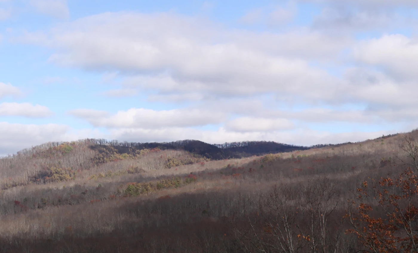
Image rights: Both photographs are National Park Service images. Warren Bielenberg photographed the active fire; Lisa Nagurny created the post-fire panorama.
Document request: We are seeking dated evacuation notices, photographs made from public locations on November 27–29, 2016, and firsthand accounts from dispatchers, hotel employees and residents who helped others leave. Submit records through the contact page.
Corrections: Smoky Mountain Files distinguishes findings in the federal review, findings in the local after-action report and later research. Send documented corrections through the contact page with the page number or record supporting the change.